
SatNav or by its more popular term, GPS, during its early adaptation by Mercedes-Benz and other European marques were cumbersome (you need DVD for the navigation computer), bulky, two-dimensional and far from being useful and the fact that it's not ready for the world, if there's a Philippine map available I don't think it's usable and price-wise practical. So bringing a grey market W211 in the Philippines with a SatNav is like having a flower pot in your dashboard.
My first experience with GPS was when a colleague lent me a Garmin nuvi 205 that I can use to navigate around the Greater Washington Area (Maryland, DC, North Virginia). Of course, that's East Coast, you can always expect a good amount of detail and accuracy when cruising around interstates, streets, suburbs and so forth. What I want to see if it is going to be as usable if I bring one back to the Philippines.
So here comes Garmin Nuvi, mine is 205W. Unlike the Jurassic-era and period-uncorrectable Comand SatNav, Garmin nuvi GPS modules does not put my W201 out of style. Because it's detachable, it can be mounted in the windshield or dashboard, it doesn't ruin the classiness of the interior specially the W124 or W210. And my next big question is will it work in the Philippines, specially in the chaotic streets of Metro Manila? Lo and behold, it does.
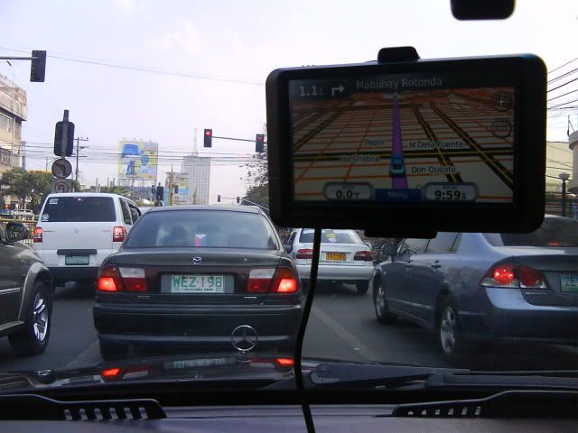
And there are two Philippine maps to choose from, the one from Roadguide and the other from Openstreetmap.org. I prefer the latter because it is updated almost daily, the streets and points-of-interests are more detailed.

It provides audible turn-by-turn instructions and recalculates when you miss a turn, just like how it works in the United States. It shows how fast you're going and your estimated time of arrival to destination.

It's First World navigation to Third World streets.

With the confusing maze of the streets in Metro Manila, when asking directions from inside your Benz cockpit is risky, it pays to have a GPS attached without ruining your style.


No comments:
Post a Comment